
Agriculture Drones and the Government's Push for Farming to Soar High
 The earthworm is a farmer’s friend and there’s no changing. But there’s another one coming into that picture which are drones, as farming involves a bit of guesswork. What would be the weather patterns? How much crop yield can be expected? Farmers have been attempting to unlock those questions with various methods and drones seem to be up for the job like no other. That’s why the Indian government has enforced funding guidelines and SOP (Standard Operating Procedure) to encourage these drones to help farmers in any ways possible.
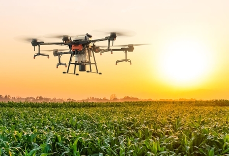
As drones in agriculture can be utilized for a variety of tasks, including precision agriculture, weed control, fertilizer distribution, and field management. Reduced operating expenses, greater crop quality, and increased yield rate are among the benefits.
To top it off, the DGCA (Directorate General of Civil Rights) recently gave the Ministry of Agriculture permission to use drones for yield estimation in 100 areas. GA will be at the vanguard of drone technology in India, driving research and development across a wide variety of applications. Clearly, India’s government is as enthusiastic about having technology shape the world of Indian agriculture which is high time that it goes digital.
Purchase or Rent Drones, the Government has the Farmers’ Back!
The Drone Federation of India hailed the release by the Union Agriculture Ministry of funding guidelines for the purchase and leasing of agricultural drones to promote their use. A wide range of agriculture institutions, custom recruiting centers, agri-entrepreneurs, and other stakeholders will be able to obtain funding for the purchase or leasing of drones thanks to the guidelines.
‘We wholeheartedly welcome this notification and would like to thank the Hon’ble Prime Minister and the Ministry of Agriculture for this bold vision that will make drones accessible to the common man of India and significantly boost domestic drone manufacturing,’said Smit Shah, president of the Drone Federation of India.
‘A conventional agriculture drone model costs between Rs. 8-10 lakhs…this step has made agricultural drone purchases almost free for premier agri-research and agri-training institutions’. These institutes, in turn, will promote the usage of agri-drones, according to Shah. According to Shah, subsidising the purchase of agri-drones will make them more inexpensive, resulting in their widespread adoption.
SOP for Use of Drones in Crop Protection
CropLife India applauded the government's decision to release a standard operating procedure (SoP) for the use of drones to spray pesticides on agriculture crops.
According to the agricultural ministry, the use of drones in agriculture has grown in popularity in recent years, and certain states are actively investigating the applicability of this new technology in Indian agriculture.
“Application of pesticides using drones has great potential as we move towards commercialization and achieving precision in agricultural crops”.
The SoP for drone regulation for pesticide application, according to the ministry, covers important aspects such as statutory provisions, flying permissions, area distance restrictions, weight classification, overcrowded areas restriction, drone registration, safety insurance, piloting certification, operation plan, air flight zones, and weather conditions.
It also includes pre-, post-, and during-operation SOPs, as well as an emergency response plan.
Drones will be allowed to spray pesticides from the air, but only under specified conditions. Operators should, for example, only use certified insecticides and formulations at allowed concentrations and heights.
Operators must provide decontamination and first-aid facilities, as well as alert the public about aerial pesticide applications at least 24 hours ahead of time through appropriate authorities. The pilots should also receive specialist training, including information on the clinical impacts of insecticides, according to the government.
"This SoP will render guidance to the stakeholders/ pilot/operators/users/regulators while undertaking safe and effective control of pest and diseases by drone-based pesticide application," said Ravi Prakash, Plant Protection Adviser at Faridabad-based Directorate of Plant Protection, Quarantine and Storage.
Pesticides are sprayed manually or with tractor-mounted sprayers in traditional agricultural techniques, when a large number of pesticides and water are utilized and a significant portion of the spray is wasted in the environment.
Drone-based spray, on the other hand, uses less water and pesticides owing to its better application and bioefficiency. CropLife India CEO Asitava Sen welcomed the SoP, saying, "It is a proud moment that the transparent deliberations within the Department of Agriculture, Central Insecticide Board, Ministry of Civil Aviation, as well as industry experts, have resulted in the pragmatic SoP and guidelines for registration requirements."
"These guidelines will now be studied and set the benchmark for ongoing engagements in other Asian countries," he said.
The industry body urged the agrochemicals industry to begin the necessary trials, apply for product registration, and collaborate with drone manufacturers and service providers for the benefit of Indian farmers, as the guidelines for pesticide registration requirements for drone application were also released at the same time.
Drones Can do More than the Guesswork
Drones can also be used to map out a region and uncover fresh information, removing much of the guesswork from the growing process. Remote sensing technology, which picks up radiation on the ground and can track everything from physical qualities to the amount of heat a place generates, is one of the keys to all of this. The best farm mapping drones take this notion a step further with multispectral imaging, which means they can record both visible and invisible light sensors within a given range. The following are two examples of maps that can be made with this type of agricultural drone:
RGB Maps: A bird's eye perspective is ideal, but even a simple Red Green Blue (RGB) map can provide new information. These maps show you exactly how much area you have to grow on down to the centimeter and aid in crop monitoring over time, allowing you to make adjustments from season to season.
NDVI Maps: The Normalized Difference Vegetation Index (NDVI) expands on the information provided by an RGB map. The map depicts how much infrared light is reflected in a certain location, which is a sign of malnutrition and dryness. This type of data collecting, according to Go Intelligence, can be used to discover damaged crops up to two weeks before visible indicators appear, making it a useful tool for farmers trying to properly predict crop failure.